Land Protection Programs
The Florida Conservation Group supports Florida’s science-based land protection programs.
We work with scientists, policymakers, agencies and landowners to ensure that our highest-priority lands are identified and protected.
Florida is a leader in science-based conservation planning and conservation. We support the protection of lands that are critical for our water resources and our wildlife. Florida scientists have identified our highest ecological priorities for our biodiversity, wildlife corridors and water quality. We partner with University of Florida’s Center for Landscape Conservation Planning (CLCP) and other partners to develop science-driven conservation tools and maps to advocate for the protection of the lands most important for protecting these natural resources vital to Florida’s future.
In Florida, we facilitate the connection between science and implementation to achieve our landscape-scale wildlife and watershed conservation and restoration goals. We are on the ground, working with landowners, agencies and decision makers to protect the most critical landscapes in Florida using the best available data from the scientists who have been working on Florida conservation priorities for decades.
The FCG is working with partners, including the CLCP, to ensure funding for land conservation protection programs and use of the best science to identify and protect the lands most strategic for protecting wildlife corridors and other statewide conservation priorities.
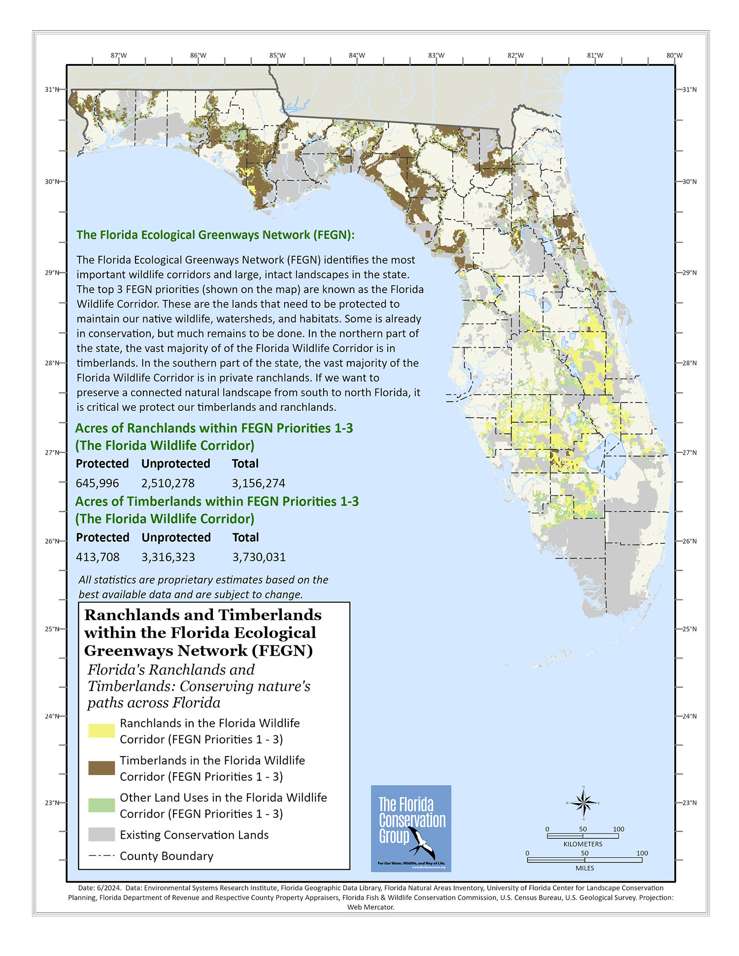
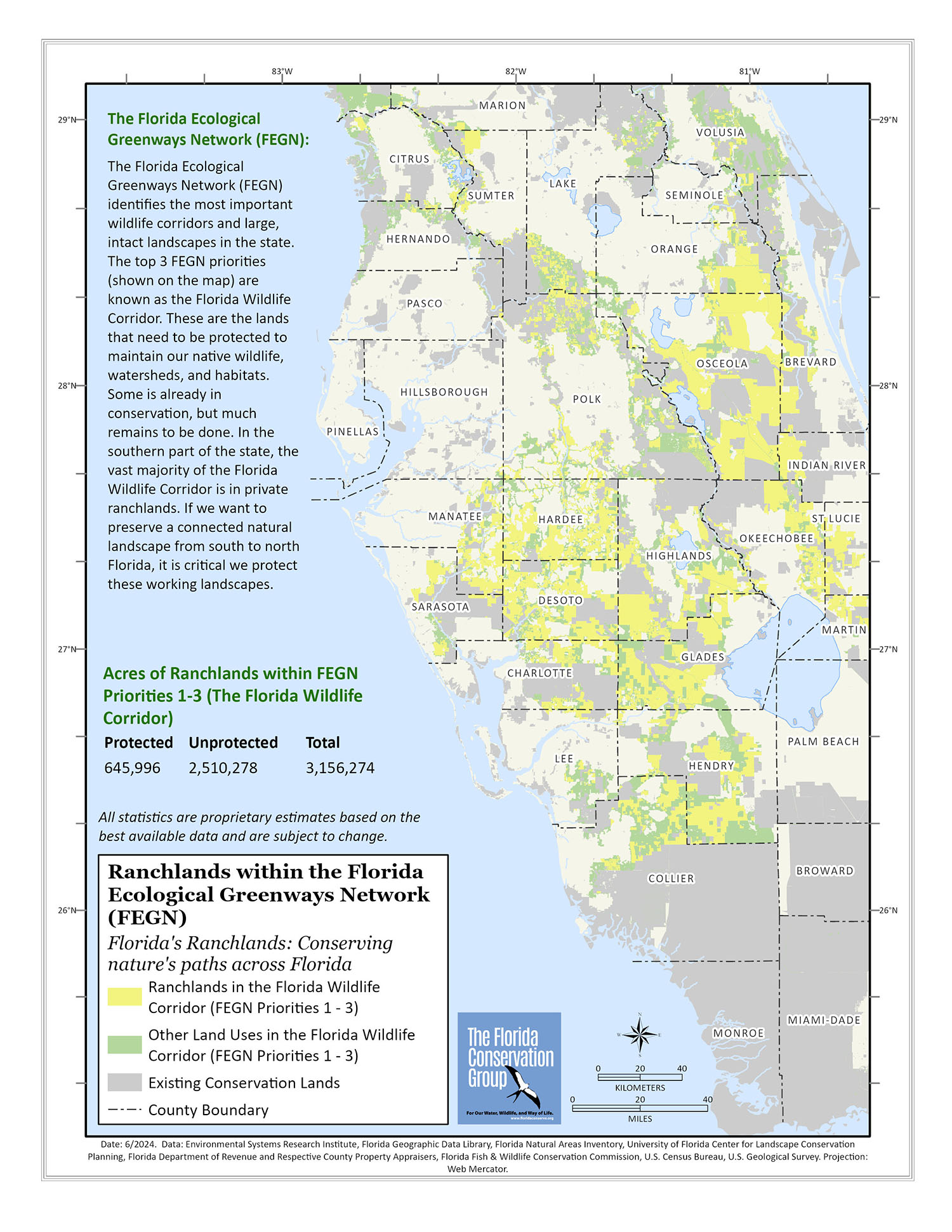
Ranch and Timberlands within the Florida Ecological Greenways Network (FEGN)
The Florida Ecological Greenways Network (FEGN) identifies the most important wildlife corridors and large, intact landscapes in the state. FEGN Priorities 1-3 are the top ranked wildlife corridors for protecting ecological connectivity, habitat, and intact watersheds; Priorities 1-3 are now known as the Florida Wildlife Corridor. Some of the FEGN is already protected, but much remains to be done. In the southern part of the state, the majority of the FEGN is in ranchlands, while in the northern half of Florida much of the FEGN consists of working silvicultural landscapes.
Ranchlands within the Florida Ecological Greenways Network (FEGN)
In the southern part of the state, the majority of the FEGN is in ranchlands; protecting ranches is thus essential for protecting the FEGN in this region of Florida. Ranches protect habitat for a variety of wide-ranging species, including the Florida panther, Florida black bear, Florida sandhill crane, crested caracara, swallow-tailed kite and short-tailed hawk. Ranchlands maintain a large connected regional landscape that is critical to the state’s water resources and other wildlife, but many ranches are threatened by the rapid pace of urban and suburban development in south Florida.
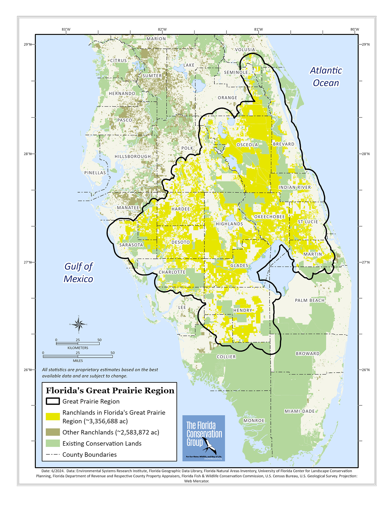
Great Florida Prairie Region and Ranches
The Florida Prairie Region was once dominated by a large dry and wet prairie ecosystem with flatwoods, hammocks, scrub, marshes and forested wetlands interspersed within them, and the region harbored many unique species only found rarely in other parts of Florida, including caracara and the Florida burrowing owl. The region later became the center of the first free range and then established ranches for cattle production. Ranching maintains similar grassland land cover as found in the prairie, and many of the species characteristic of the prairie landscape persist in the remaining open, vast grasslands of the region. However, conversion to other forms of agriculture, mining or suburban/urban development threaten these wildlife species and watershed functions of the Great Florida Prairie region.
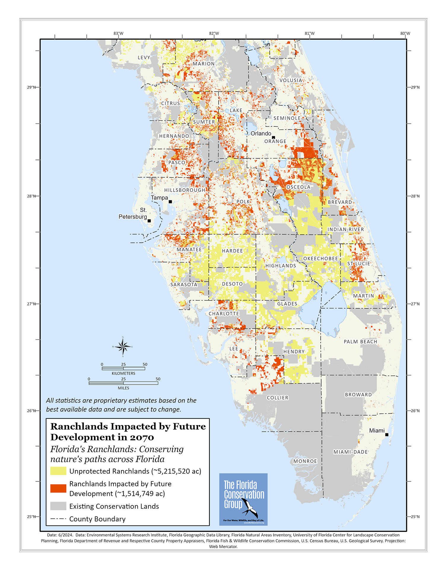
Ranchlands Impacted by Future Development in 2070
The State of Florida is one of the fastest growing in the nation, with an average of about 1,000 people moving to the state each day. Future development scenarios produced by the University of Florida Center of Landscape Conservation Planning show that southwest and south-central Florida ranchlands are particularly threatened by future development. The Florida Conservation Group is working assiduously to protect these landscapes and ranchland uses that are compatible with water resource and wildlife conservation goals before they are lost forever.